• WORK
  • REEL
  • INFO
  • ARCHIVES
DAN DEGLORIA
  • WORK
  • REEL
  • INFO
  • ARCHIVES

MAPS


21 BRIDGES
Maps of lower Manhattan created for a feature film. Pictured are both the photo-real and graphic representations of the area because client wanted the variation flexibility to break up the multiple screens these were displayed on in the film.

SatelliteMap_05-(0-00-13-15).jpg SatelliteMap_05-(0-00-23-17).jpg SatelliteMap_05-(0-00-33-17).jpg SatelliteMap_05-(0-01-03-06).jpg SatelliteMap_05-(0-01-23-28).jpg SatelliteMap_05-(0-01-36-02).jpg SatelliteMap_05-(0-02-11-19).jpg SatelliteMap_05-(0-02-30-25).jpg SatelliteMap_05-(0-02-52-18).jpg SatelliteMap_05-(0-03-17-00).jpg SatelliteMap_05-(0-03-33-17).jpg SatelliteMap_05-(0-04-07-06).jpg
Examples of OEM (original equipment manufacture) graphics over map imagery from the movie 21 Bridges.
DoubleScreen_RoadMap_01_2400px.jpg

LONE STAR ANIMAL RESCUE
This was a quick request for a pilot episode. I created it in one seamless move but the production company edited into individual clips throughout the pilot episode.


HOW CLOSE CAN I BEACH?
Two seasons of maps were created for this network television series on HGTV. Stills were created at 3 different elevation levels, state wide, city/town, and street level. The stills were then used by editorial as they applied a simple push-in and animated umbrella locator delivered as a keyable graphic.
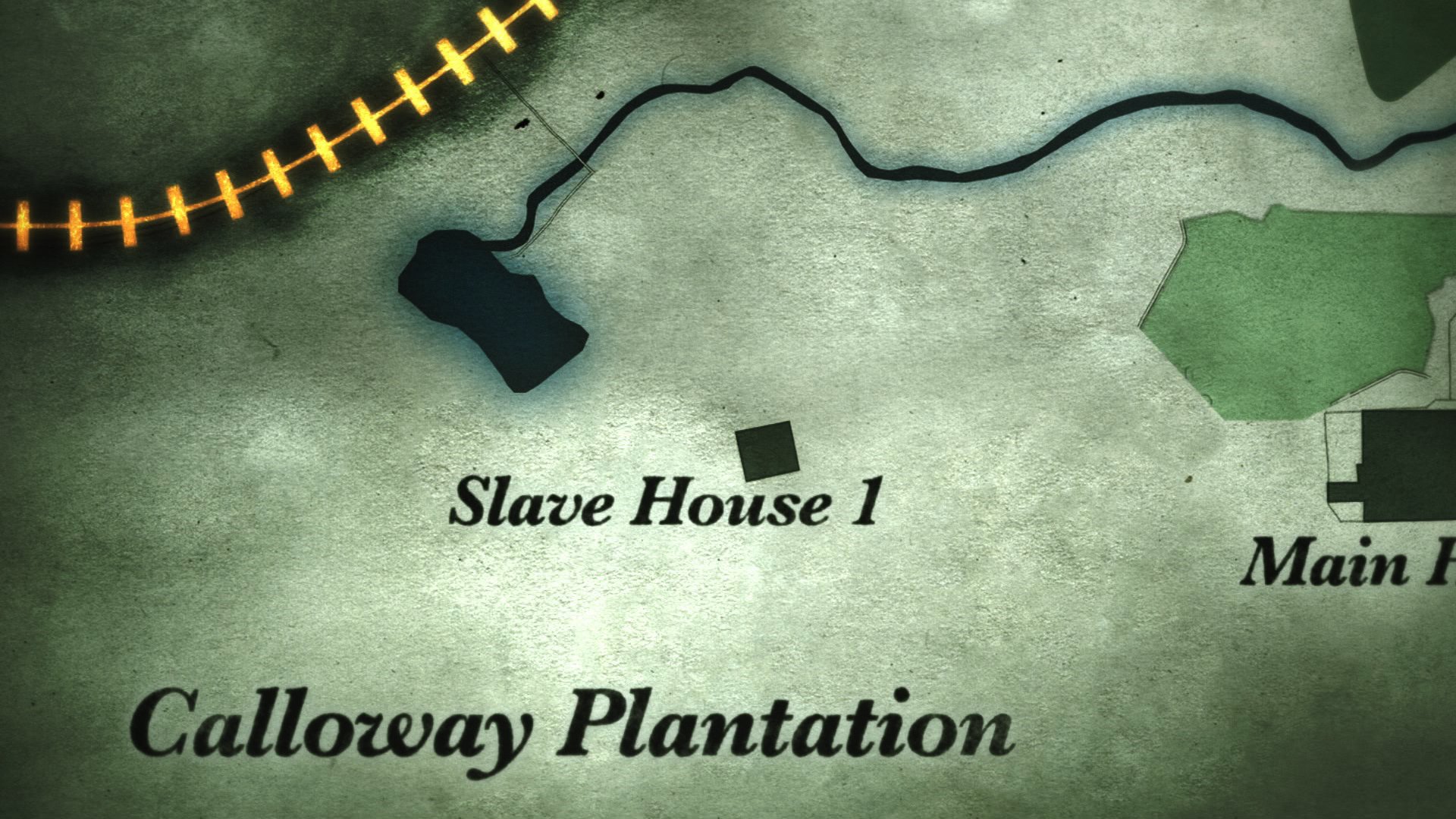
201_HCCIB_Map_CU_HeroHouse1_v2.jpg 201_HCCIB_Map_CU_House2_v2.jpg 201_HCCIB_Map_CU_House3_v2.jpg 201_HCCIB_Map_MEDIUM_v2.jpg 201_HCCIB_Map_WIDE_v2.jpg 206_HCCIB_Map_CU_HeroHouse1.jpg 206_HCCIB_Map_CU_House2.jpg 206_HCCIB_Map_CU_House3.jpg 206_HCCIB_Map_MEDIUM.jpg 206_HCCIB_Map_WIDE.jpg

YEAR OF THE ROOSTER
This was a very large map that spanned a good distance. We wanted to create only one map that we could travel along, pushed-in at times to show specific locations while maintaining proper image quality for animation.

MAP_WIDE_Master_alt_halfsize_1.jpg MAP_WIDE_Master_alt_halfsize_2.jpg MAP_WIDE_Master_alt_halfsize_3.jpg MAP_WIDE_Master_alt_halfsize_4.jpg MAP_WIDE_Master_alt_halfsize_5.jpg MAP_WIDE_Master_alt_halfsize_6.jpg
MAP_WIDE_Master_alt_halfsize.jpg

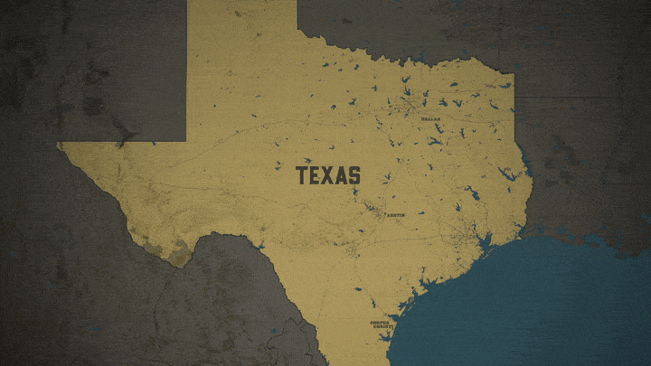
ROCKY MOUNTAIN BOUNTY HUNTERS
Pictured here are the maps that were produced and early designs presented at the bottom to show a bit of the evolution.
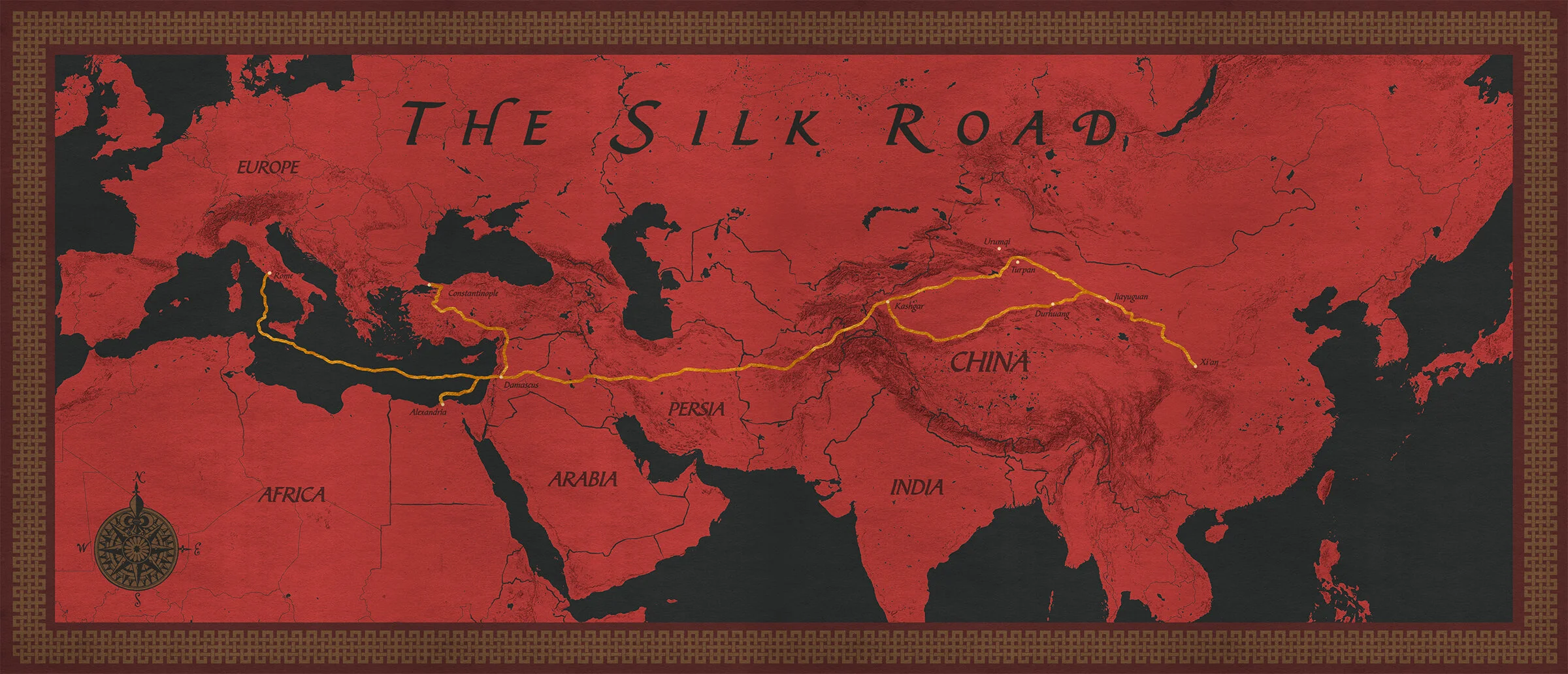
RMBH_0000_Layer 33.jpg RMBH_0001_Layer 32.jpg RMBH_0002_Layer 31.jpg RMBH_0003_Layer 30.jpg RMBH_0004_Layer 29.jpg RMBH_0005_Layer 28.jpg RMBH_0006_Layer 27.jpg RMBH_0007_Layer 26.jpg

REBEL GOLD
Created a massive amount of maps for this 4-part mini series on Discovery. This is an example that uses multiple elevations to show different levels of detail. Each level was animated separately as stand alone maps.

RB_23.jpg RB_22.jpg RB_18.jpg RB_17.jpg RB_19.jpg RB_14.jpg RB_13.jpg RB_20.jpg RB_09.jpg RB_07.jpg RB_08.jpg RB_01.jpg RB_26.jpg

All content subject to © by Daniel DeGloria LLC